


All-Weather, All-Hours: Introducing the DJI Matrice 5T
Managing remote assets and conducting search operations across New Zealand terrain demands adaptability. Field crews inspecting high-voltage lines, solar farms, or bridge undersides frequently face difficult access, signal obstruction, and challenging weather conditions. Deploying multiple platforms or constantly swapping payloads in the paddock drains daylight hours and increases the time staff spend in hazardous environments.
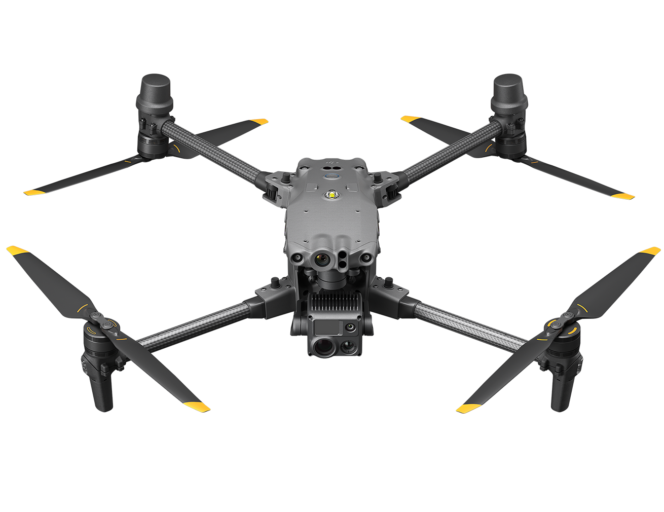
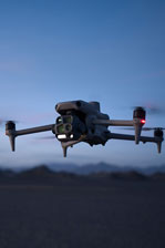
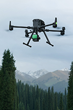
To help operators overcome these boundaries, Ferntech is introducing the DJI Matrice 5T. By integrating a multi-sensor payload with advanced environmental sensing, the Matrice 5T is a compact, foldable flagship that allows teams to capture critical data safely across challenging lighting and terrain conditions.
Advanced Low-Light and Thermal Imaging
Night operations or low-light inspections no longer mean relying solely on thermal imaging. The Matrice 5T introduces a 1/0.98-inch 50 MP wide-angle camera capable of capturing vivid full-colour imagery in conditions as dark as 0.01 lux. Complementing this is a new 1280 × 1024 native thermal resolution sensor, quadrupling the pixel count of the previous Matrice 4T generation. An Ultra-High-Resolution (UHR) mode can further increase the output to 2560 × 2048, ensuring heat anomalies remain clearly defined even against complex backgrounds.
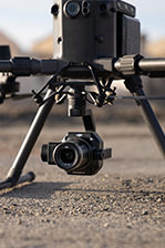
For detailed structural checks, operators can utilise the 50 MP medium telephoto camera with 3× optical zoom, or the telephoto camera offering 11× optical and up to 176× hybrid zoom alongside monochrome night vision. A built-in laser rangefinder measuring up to 3,000 metres allows teams to instantly pinpoint targets, drastically improving efficiency during search and rescue operations or asset marking.
Built for Complex Environments
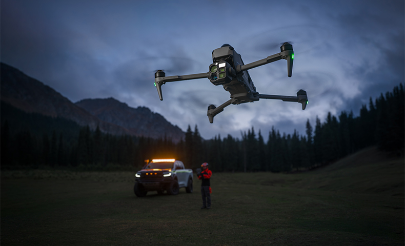
Safety and stability in demanding environments have been significantly upgraded. For the first time in a compact enterprise drone, DJI has integrated 360° LiDAR, millimetre-wave radar, and an omnidirectional vision system into a single platform.
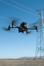
This means the Matrice 5T can detect thin obstacles like power lines up to 32 metres away at night, while the radar cuts through interference to sense surroundings in fog, rain, or dust. Operating with an IP55 rating, it ensures reliable deployment in unpredictable coastal and alpine conditions for up to 59 minutes of flight time. The platform also features O4 Enterprise Transmission, delivering a stable link up to 40 kilometres, with adaptive multi-band switching and dual cellular dongle support to overcome signal blockages in steep topography.
Rapid Intelligence and On-Site Modelling
When time is critical, the Matrice 5T processes data at the edge. The system features built-in AI capable of natively detecting over 20 target types across both thermal and visible feeds simultaneously.
For rapid situational awareness, the remote controller can process 200 photos in just eight minutes, generating local point clouds or 2.5D models directly in the field without needing an internet connection. This rapid mapping capability is invaluable for emergency responders assessing a scene or engineers auto-planning precise flight routes over a substation.
Authoritative Support and Integration
Successfully deploying an enterprise drone requires more than just acquiring the hardware. It requires a structured approach to compliance, integration, and maintenance.
As a New Zealand commercial drone supplier, Ferntech delivers comprehensive technology solutions across agriculture, forestry, surveying, and public safety. Our specialist team assists operators with navigating Civil Aviation Authority (CAA) Part 102 certification, coordinating certified pilot training, and establishing robust standard operating procedures. Supported by our DJI-certified Auckland repair centre, we ensure your fleet remains compliant, safe, and fully operational season after season.
Learn More About the Matrice 5 Series
DJI Matrice 5T FAQs
1. What are the biggest upgrades over the Matrice 4T?
The main upgrades include four times the native thermal pixel count, longer-reach telephoto imaging, IP55 protection, built-in LiDAR and radar, longer flight time, and the RC Plus 3 Enterprise controller. Integrated cellular hardware, expanded airborne relay, and controller-based mapping also extend field capabilities.
2. What is the Matrice 5T useful for in New Zealand?
Its strongest applications include locating missing people, inspecting electricity lines and solar panels, checking roofs and bridges, and operating from vessels. Thermal, zoom, and low-light cameras allow teams to collect multiple views of the same target with one portable aircraft.
3. Is the Matrice 4T being discontinued, and is a Matrice 5E coming?
The Matrice 4T and Matrice 5T remain on sale together. There is currently no news regarding a Matrice 5E release.
4. Is the Matrice 5T the same as the Matrice 5TD?
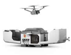
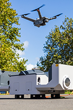
No. The Matrice 5T is a foldable aircraft deployed from a carrying case, whereas the Matrice 5TD is designed specifically for the Dock 4 platform. The Matrice 5T does not use the Dock, and its spotlight and speaker accessories are distinct from the 5TD versions.
5. What is the thermal resolution, and what does "2K" mean?
The native thermal resolution is 1280 × 1024, which is four times the pixel count of a 640 × 512 sensor from the Matrice 4T. It supports 2K software-enhanced thermal imaging and up to 32× digital zoom. The enhanced mode processes the image, but the native sensor resolution remains 1280 × 1024.
6. How close can the thermal camera focus?
The minimum thermal focus distance is 10 m. This is critical for close inspection work on roofs, electrical equipment, and structures, as moving closer can put the thermal image out of focus even when the visible-light image remains sharp.
7. What visible-light cameras and zoom does it have?
It features a wide camera with a 1-inch sensor class, a 3× mid-telephoto camera, and an 11× telephoto camera. Maximum visual zoom reaches 176×, including digital enlargement. The mid-telephoto view helps capture inspection detail while keeping more of the asset in frame.
8. What can the cameras see in low light?
All three visible-light cameras support colour night modes. The telephoto camera also supports monochrome night vision with its IR-cut filter removed, assisted by a near-infrared illuminator reaching up to 100 m. Thermal imaging provides an independent view of heat signatures.
9. Can it measure temperatures and highlight hotspots?
Yes. It supports area temperature measurements, threshold alarms, thermal picture-in-picture, and adjustable fusion with visible imagery. Thermal AI recognises patterns in the infrared image, while temperature alarms respond to a selected threshold. It also supports specialist calibration using a blackbody reference.
10. What makes it useful for search and rescue?
Thermal imaging helps locate heat signatures, while zoom and low-light cameras identify what the team has found. The 3 km laser rangefinder allows teams to mark target locations, and FlightHub 2 sharing passes information to other members. The optional spotlight and speaker can assist in communicating with a person or guiding a ground team.
11. Is it suitable for solar-farm and electrical inspections?
Yes. Higher thermal resolution reveals smaller temperature anomalies across panels and electrical assets, supported by detail from the visible-light cameras. Operators must account for the 10 m minimum thermal focus distance when planning close inspections.
12. Can it automatically inspect power lines?
Yes. The line-inspection tool follows conductors or ground wires and captures images at selected zoom and interval settings. Built-in sensing supports power-line detection by day and night at up to 32 m under suitable conditions, bringing automated line-following to a portable aircraft.
13. Can it inspect underneath bridges or work with limited GPS?
Yes. Its combined sensing system supports positioning in low- or no-GNSS environments. The camera tilts up to 90° for viewing overhead structures, and the AL2 spotlight can illuminate upwards, which is ideal for bridge undersides where satellite reception is restricted.
14. How well does it handle outdoor conditions?
The aircraft features IP55 protection and an operating temperature range of −20°C to 50°C. LiDAR, millimetre-wave radar, and omnidirectional vision handle obstacle sensing. Anti-icing propellers are available separately.
15. How long does it fly, and what do the range figures mean?
Maximum flight time is 59 minutes, with up to 54 minutes of hover time. Planning for 40–45 minutes is a practical starting point, depending on conditions and reserves. Maximum transmission distance is 40 km, and maximum total flight distance is 45 km.
16. How quickly can it charge, and how many batteries are needed?
The 515 W charging system takes a battery from 10% to 95% in approximately 30 minutes. With suitable power, three batteries support continuous rotation through flying, cooling, and charging. The hub charges sequentially and includes active cooling.
17. Does it support battery hot swapping?
No. The aircraft must be powered down to replace the flight battery. However, an optimised startup allows for retakeoff in as little as 10 seconds to shorten turnaround times.
18. Can I take the flight batteries on a passenger plane?
No. The 215 Wh flight battery exceeds Air New Zealand’s 160 Wh passenger-baggage limit, meaning it cannot travel in carry-on or checked baggage. Partly discharging it does not change its rated capacity. Operators must arrange battery freight ahead of time for domestic jobs involving passenger flights.
19. What is new about the controller?
The RC Plus 3 Enterprise features a 1920 × 1440, 2,000-nit display with a 4:3 layout. It supports combinations of camera feeds, vision assist, and maps. The internal battery runs for up to six hours and charges via USB-C; there is no removable external battery.
20. Does it need a separate 4G dongle?
No. Cellular hardware is built in, featuring two nano SIM positions in the aircraft and one in the controller. The aircraft automatically selects the stronger network link.
21. How does airborne relay work?
A Matrice 5T can relay the connection to another active Matrice 5T, overcoming radio-path obstructions like steep terrain. Supported configurations include one controller with two aircraft, two controllers with two aircraft, and two controllers with three aircraft (including a two-hop relay option). Current relay support is exclusively Matrice 5T-to-Matrice 5T.
22. Can it produce maps, and does it have a mechanical shutter?
The controller can generate a 2.5D map from 200 photos in approximately eight minutes for rapid scene assessment. The wide camera uses an electronic rolling shutter with precise image-positioning information and Terra processing to compensate for motion effects, supporting RAW images and a 0.5-second photo interval.
23. What AI and custom software does it support?
It supports over 20 built-in object categories using visible-light or thermal imagery. Visible-light recognition can filter people by clothing colour. It provides 10 TOPS of onboard computing for custom AI models and supports Pilot 2 plugins for industry-specific mission planning and annotation.
24. Does it work with FlightHub 2 and DJI Terra?
Yes. FlightHub 2 handles sharing, coordination, and remote piloting, while Terra supports mapping and modelling, including thermal reconstruction. Remote piloting still requires the aircraft to be physically deployed on site.
25. What spotlight and speaker does it use?
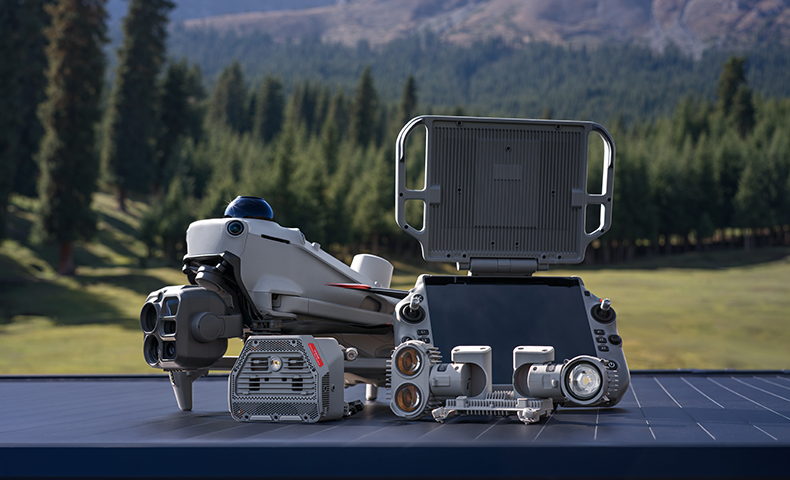
It uses the Matrice 5T AL2 spotlight and AS2 speaker, which can be fitted together. The spotlight provides spot, flood, and strobe modes. The speaker supports live broadcast, loops, text-to-speech, and coloured strobes, with a broadcast reach of up to 400 m under suitable conditions.
26. Can it carry third-party payloads?
Yes. It supports up to 400 g of accessories. Third-party installations require compatible mounting, power, and clearance.
27. Can it take off from and land on a moving boat?
Yes. It supports boat launch and automated recovery using a specific visual landing pad, allowing for landings on vessels moving at up to 10 knots.
28. Should I choose it over a Matrice 400 with an H30T?
The Matrice 5T suits teams prioritising portability alongside an integrated camera system. A Matrice 400 setup offers different payload flexibility for more demanding inspection requirements.
29. What additional support is planned?
AP1 parachute support is scheduled for early 2027. Manifold 3 compatibility and relay support with earlier aircraft models are also planned for future updates.
30. What warranty and maintenance provisions apply?
Basic maintenance is recommended roughly every six months, depending on usage. Standard maintenance should occur every 12 months or 200 flight hours, whichever occurs first. Specific warranty expiration dates are available via DJI service records. The drone includes one year of complimentary Enterprise Care Plus, offering coverage for a single flyaway incident, with renewal options extending up to five years.
Evaluate the Fit for Your Operation
If you’re evaluating how the DJI Matrice 5T could fit into your fleet, complete the form below and our Commercial Solutions team will get back to you to discuss your requirements.
SPEAK WITH A SPECIALIST
Contact our team today to discuss the right solution for you.