


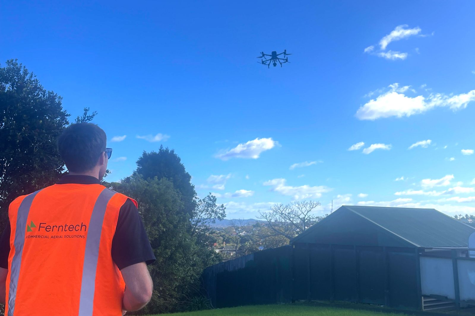
Drones – A Safer, Smarter Solution for Disaster & Emergency Response
When disaster strikes, gaining fast, accurate data on impacted areas and infrastructure is vital – not just for assessing the current damage, but for preventing further incidents and risk to local communities. Since Ferntech began in 2013, we have seen a steady rise in the use of drones across New Zealand, particularly for disaster response. With natural disasters and emergencies at the front of everyone’s minds, we’re taking a closer look at how surveyors, contractors, and local councils can take advantage of drone technology to deliver faster, safer, more effective emergency and disaster response.
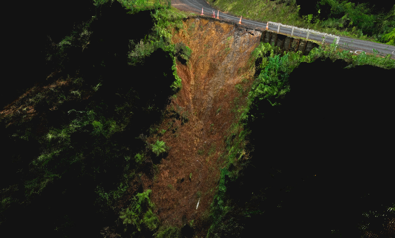
Traditionally, topographical surveying is carried out using a robotic total station or GNSS rover. While both have their advantages, they require methodical land coverage on foot to collect measured points to trace features, followed by a gridded approach to establish the topography’s shape. When compared to drone surveying, these methods take much longer, carry higher risk to the people involved, and deliver far fewer data points, which often leads to a lower quality data set. In times of emergency or disaster, this type of assessment just won’t fly.
On Anniversary Weekend 2023, Auckland was left scrambling as it received “an entire summer's rain in less than a day” during what NIWA dubbed as a 1-in-200-year event. This extreme weather had a dramatic impact on the city’s infrastructure, landscape, and local communities, with flooding closing roads, shops, and businesses, and causing significant slips and landslides across the region. While progress has been made in the months that followed, Auckland remains prone to significant flooding.
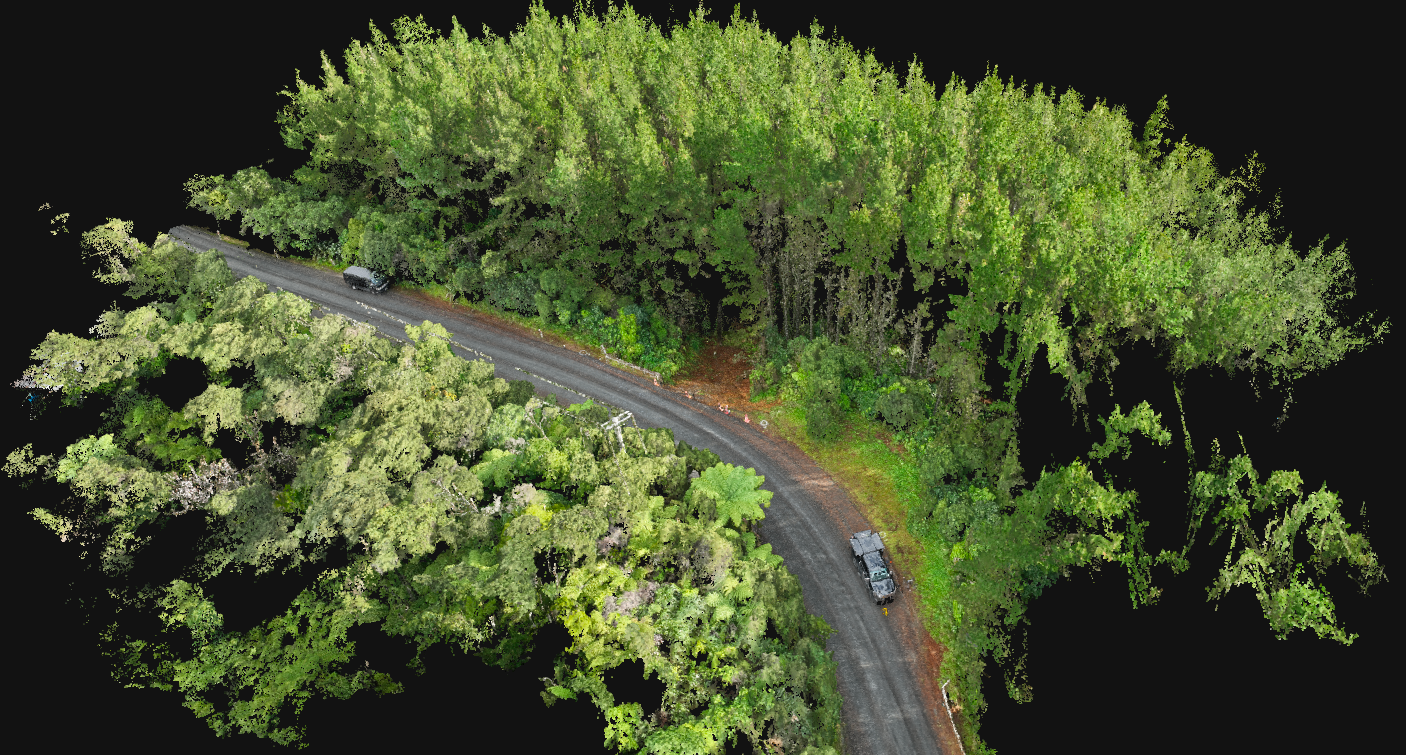
We recently spoke with Michael Cutfield, General Manager at Survey Worx, about the surveying work his team has been doing, and how drones have helped deliver key site data that can be used for disaster recovery. Market leaders in land surveying, Survey Worx have increasingly been using drones for slip assessment in recent years, as it becomes the industry standard for reality capture for remediation design purposes.
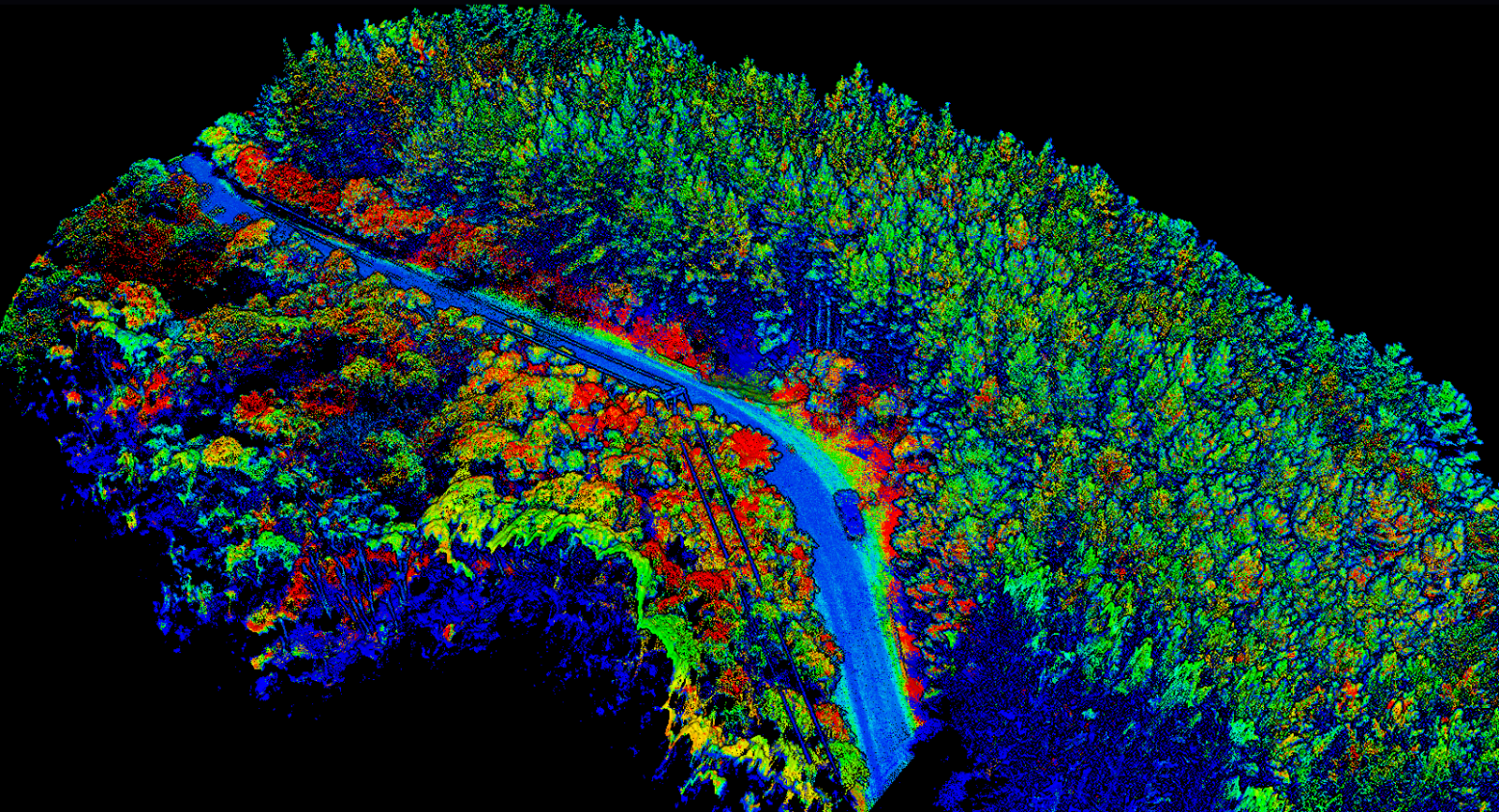
Supported by the Ferntech team, they use DJI drones to capture raw photogrammetry and LiDAR data via aerial site assessments. This raw data is then processed to produce point clouds, with the photos run through photogrammetry software and the LiDAR run through DJI Terra. These point clouds are cross-checked and compared with the ground control points (GCPs) for accuracy. Once accuracy is confirmed, the features of the point cloud are modelled, the ground surface is extracted and contoured, and the orthomosaic image is placed to produce a plan. The point cloud is tidied up by reducing the noisy points and is sometimes decimated if it is too large.
Upon completion, Survey Worx produces a plan in pdf format, including the photo, CAD features, contours, and annotation explaining all the features. This plan is also issued in digital CAD format together with the digital image correctly geolocated, as well as the point cloud – all of which can be used by the designers. When asked about the key benefits of using drones for this line of work, Mr Cutfield identified the following three factors:
- Using drones for survey mapping significantly increases productivity on large sites, which improves exponentially as site size increases;
- Data quality is improved as millions of data points are collected compared to 100s or 1000s via traditional methods, resulting in topology that is much more accurately defined;
- By using remote sensing to collect data, drones dramatically improve safety as people no longer need to be physically present for data collection.
Going beyond this type of responsive work, drones can also be employed on a range of preventative maintenance projects. By closely assessing rock formations and land shapes around regions with historic slips, new data can be captured to help identify potential risk zones, plan evacuation routes, and guide preventative measures to mitigate further damage. This type of work is particularly important when considering less predictable and more complex disasters, such as the Kaikōura earthquake in 2016.
Described by scientists as one of the most complex earthquakes ever recorded with modern instrumental techniques, this event caused extensive damage to farms, beaches, highways, and railway lines – in some cases causing giant fissures to open in the ground. Because of its unique scope and scale, aerial drones were extensively used as a safe, efficient solution for post-disaster assessment.
GNS Science, New Zealand’s Crown Research Institute, released drone flyover videos of the Kekerengu Fault and Papatea Fault a week after the earthquake, providing a bird’s eye view of the enormous impact – a job that would have previously taken several man hours, with high risk to the people involved. By combining this type of aerial imagery with geological data, scientists and engineers can gain much needed insight into the behaviour and impact of earthquakes across New Zealand.
From slip assessment and hazard mapping, to post-event reconnaissance and search and rescue with thermal imaging, the importance of drones for emergency and disaster response cannot be understated. Combining safe access to hard to reach areas with increased project efficiency and data accuracy, drones add another layer of safety and preparedness for communities facing the aftermath of a disaster or emergency. By providing the latest drone solutions and support to customers and local communities, Ferntech will continue to ensure the effective use of this technology for future disaster management and relief operations.
Note: This article was originally published in Surveying + Spatial Magazine – Issue #112, June 2023
SPEAK WITH A SPECIALIST
Contact our team today to discuss the right solution for you.


