


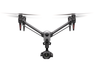


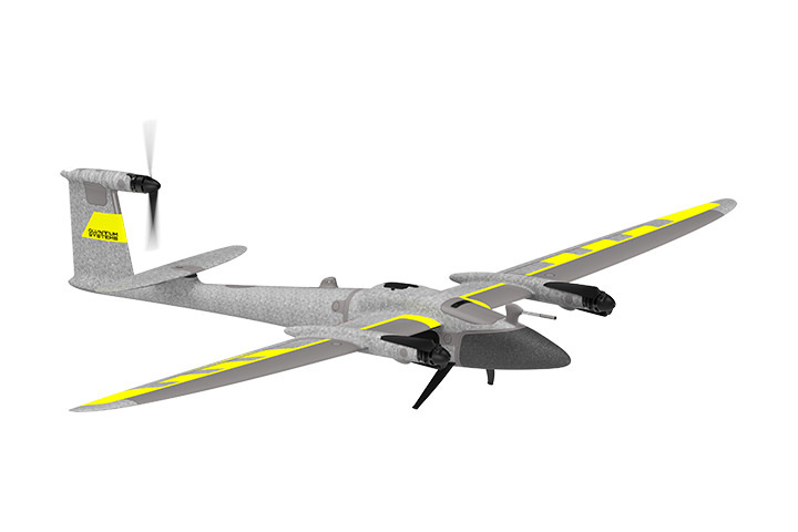
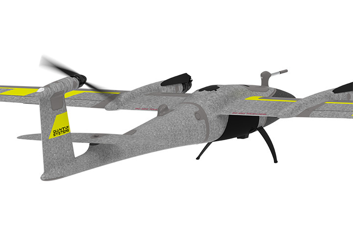
Trinity Pro Fixed Wing Mapping Drone
The Quantum-Systems Trinity Pro is a future-proof, reliable and easy to use fixed wing mapping solution.
Features
A future-proof, reliable and easy to use mapping solution
Trinity Pro is designed to adapt to changing requirements, evolve in capabilities, and accelerate decision making through aerial data. Future integrations like AI capabilities give new insights and help professionals in various industries to make more informed decisions and drive their business forward.
.jpg)
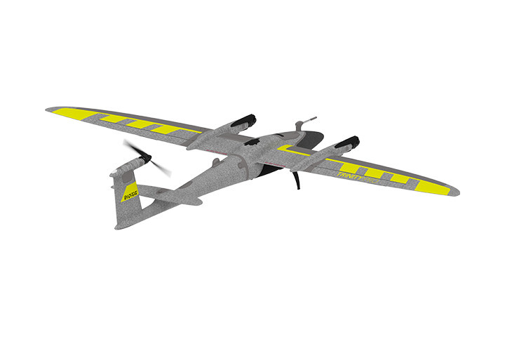
Expand your business opportunities with Trinity Pro
Future-proof investment
The Trinity platform was introduced to the market in 2018. With more than 60,000 flight hours on a global scale it has proven its performance, accuracy, and reliability. The Trinity Pro incorporates the latest technology: The new Quantum-Skynode autopilot and the Linux misson computer bring computing power and increased internal storage as well as enhanced connectivity onboard the aircraft. This allows downstream integration of next generation cameras, but also of logging, simulation and AI capabilities.
Easy and safe operations
Trinity Pro is combined with our proprietary mission control software QBase 3D. They form a completely integrated system. During field operation, Trinity Pro gives the operator peace of mind. The new autopilot has the latest safety features, ensuring the UAV is flying in the safest possible way. This includes automatic self-diagnostics, terrain awareness, wind simulation and AI powered “return to home”. Potential detected risks are reported during mission planning and before take-off. Future industry specific software connections will also fully integrate with the system and make post-processing work easier. Users can create application-specific reports and analyses without having to spend time establishing new and complicated processes.
Growth-enabling versatility
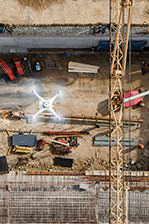
With the ability to perform in the most challenging environmental conditions, Trinity Pro captures more data per mission than almost any other comparable drone on the market. Trinity Pro also comes with the largest range of integrated sensors in the industry, which are simply “plug and play”. The constant expansion of our software solutions, and the proprietary nature of our software stack allows us to push the envelope for both the drone’s capabilities, and the operational and workflow features.
High uptime, maximized outcome
Quantum Systems has a proven track record of 60,000+ hours of flight with the Trinity platform. The Trinity Pro takes all the advancements in safety and reliability from this and takes it a step further. With the Quantum-Skynode autopilot the Trinity Pro performs enhanced system monitoring of all onboard systems to ensure perfect operations and predict maintenance. The new Quantum Systems Customer Portal is ready to guide new users through all processes and operations with online material and courses. Our world-class support, service, and training team are standing by and ready to help in case more help is needed.
18m/s - Wind Tolerance
700ha - Area Coverage
4800m - Take-off altitude
90min - Flight Time
.jpg)
Designed to evolve
Ready for tomorrow.
Add Trinity Pro to your portfolio and it will take you into the future. The platform has proven its performance, reliability and accuracy since market launch in 2018. The new Trinity Pro incorporates the latest technology including a new autopilot, making it ready for the future.
Quantum-Skynode autopilot
The new Quantum-Skynode autopilot brings computing power, increased internal storage and enhanced connectivity onboard the aircraft. Downstream integration of next generation cameras, AI capabilities and application specific software connections for better streamlined workflows becomes a simpler matter. New capabilities can be added as the technology evolves.
90 Minutes Flight Time
Due to its refined aerodynamics, the Trinity Pro uses less energy and achieves unmatched flight times of 90* minutes and longer. During flight, it can cover large areas (700 ha/ 1,730 acres) or long corridors (100 km/ 62 miles), making it the surveying tool of choice for a broad variety of applications.
*Subject to export regulation
Advanced self-diagnostics
Extensive pre-flight checks and auto servo calibration give the user confidence in the system and little to worry about. Potential detected risks are reported during mission planning in QBase 3D and before take-off. This is reducing the risk of an adverse event during flight.
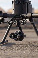
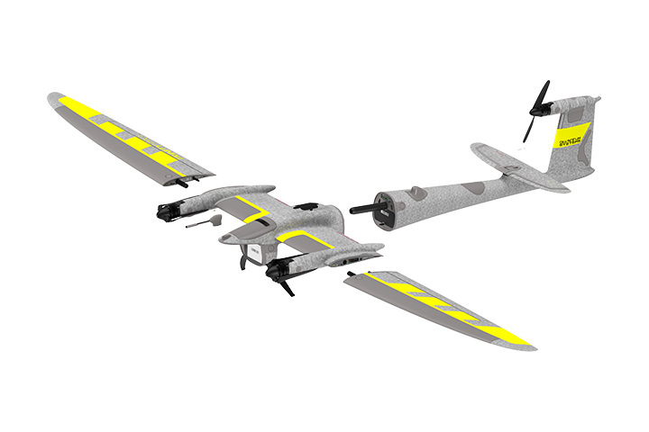
Easy-to-swap sensors
Trinity Pro comes with the largest choice of sensors, compared to other fixed-wing UAVs in the market. And they are very easy to swap. The Quantum Systems payload compartment allows for an easy swap of sensors within seconds using the quick-lock mechanism. The sensors are seamlessly integrated to support mission planning in QBase 3D, allowing frequent changes in the surveying application. Choose from RGB, Oblique, multispectral and even LiDAR.
Drone-based LiDAR technology
Trinity Pro comes with the largest range of sensors in the industry, which are simply “plug and play”.
The Qube 240 LiDAR scanner was introduced in 2021, which has been transformative for the industry. The Qube 240 produces survey grade results, weighs only 930 grams, and can be easily mounted on the Trinity Pro.
PPK Included
All Trinity Pro UAVs are equipped with an entry-level GNSS reference station, the Quantum Systems iBase. It automatically logs GNSS reference measurements on the ground to a file on a microSD card. The file enables the post processing software to do PPK processing of the data collected in-flight and drastically reduce the GNSS positioning errors.
Real corridor mapping
The QBase 3D software has been extended with additional features including the ability to take-of from and land in different locations (A/B missions). This is finally enabling true long corridor mapping and paving the way to BVLOS flights.
Advanced terrain avoidance
A down facing LiDAR allows for safe and BVLOS ready flight plans, including safe landings.
Backpack
A backpack to carry and store Trinity Pro in small pack size is offered as an option.
IP 55 rating
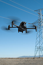
Users benefit from the IP 55 rating for our drone when operating in challenging environments. It is broadening the application capabilities while reducing risk to the unit.
The Quantum Systems Customer Portal
Register your drone and get access to the Quantum Systems Customer Portal. It will guide new users through all required steps when starting operation, also offering online classes. Our world-class support, service, and training team are standing by and ready to help in case more support is needed.
Offsetting CO2
With the sale of each Trinity Pro, Quantum-Systems protects an area of 64 square meters in the Peruvian Amazon rainforest. By protecting primary native forests in Peru, together with the Wilderness International Foundation, each Trinity Pro sold is offsetting part of its CO₂ footprint.
.jpg)
QBase 3D
Trinity Pro and our QBase 3D software form a completely integrated system that lets you plan and execute your missions with ease. Benefit from cutting-edge safety features such as extensive pre-flight checks, automatic wind simulation and advanced terrain following.
Trinity Pro Cameras
Trinity Pro currently comes with six different fully integrated cameras, including RGB, oblique, multispectral and LiDAR. They are easy to swap using the quick-lock mechanism of the payload compartment. The entire system architecture allows easy downstream integration of next generation cameras and simpler workflows.
Product Specifications
Max. Take–off Weight: 5.75 kg (12.68 lbs)
Max. Flight Time: 90 min (subject to export regulation)
Max. Area Coverage: 700 ha
Max. Flight Altitude (MSL): 5500m (18,045 ft)
Command and Control Range: 5 – 7.5 km (3.1 – 4.7 mi)
Optimal Cruise Speed: 17 m/s (33 kn)
Wind Tolerance (hover phase): 11 m/s (21.4 kn)
Wind Tolerance ( continous/ cruise): 14 m/s (27.2 kn)
Wind Tolerance (gusting/ cruise): 18 m/s (35 kn)
Operating Temperature Range: -12° C to 50° C (10.4° F to 122° F)
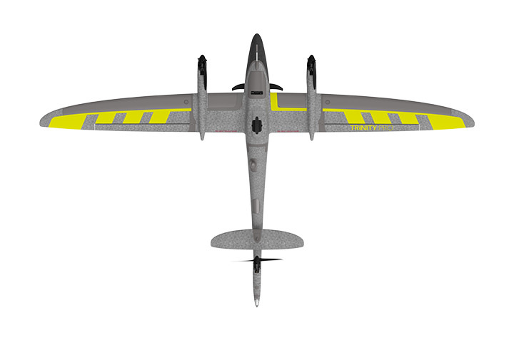
Wingspan: 2.394 m (7.85 ft)
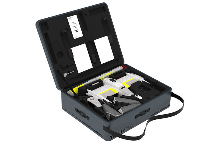
Transport Case Dimensions: 100.2 x 83 x 27 cm (39.4 x 32.7 x 10.6 inch)
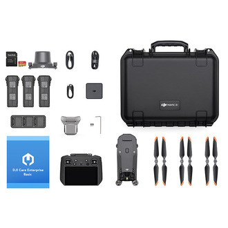
In the box
Trinity Pro Fixed Wing Mapping Drone × 1
WHY BUY FROM US?
By buying from Ferntech, you'll have the confidence that you are dealing directly with New Zealand's leading drone experts. Our staff are knowledgable drone pilots who offer expert advice, trusted support and superior specialist service. Only through us will you receive a full New Zealand warranty, phone and email support, and access to our certified Repairs Centre with DJI-qualified drone technicians. And we guarantee that we will have the best prices on the market — if not let us know and we will match any price (conditions apply).
Warranty Details
.
There's currently no reviews for this product, be the first to write one.
Related Products
$48,281.00
$1,150.00
$9,476.00


