


Case Study: How BBV is Using DJI Drones to Save £5 Million on HS2 Project
More accurate surveying. Safer inspections. Increased mapping efficiency and accuracy. The list of commercial applications for aerial drones grows every day, as more businesses and organisations embrace this game-changing technology. Read our case study below to see how Balfour Beatty VINCI (BBV) will achieve an estimated $10 million (£5 million) in cost savings and additional efficiencies by using DJI drones on the HS2 infrastructure project in the UK.
What is the HS2 project?
The HS2 Project is Britain’s new $212 billion (£106 billion) development that will create a high-speed rail system connecting 30 million people across London, Manchester, Birmingham, and the largest cities in Scotland. Not only is it Europe’s biggest infrastructure project, but it is also the most important economic and social regeneration project in decades.
The first phase of the project is being designed and built by joint venture Balfour Beatty VINCI (BBV), covering approximately 90 km and costing $9.6 billion (£4.8 billion). This initial development includes 37 viaducts, 72 overbridges, 56 culverts and underbridges, 63 embankments, as well as the construction of four motorway crossings and supporting structures to accommodate existing railway services.
Core project challenges
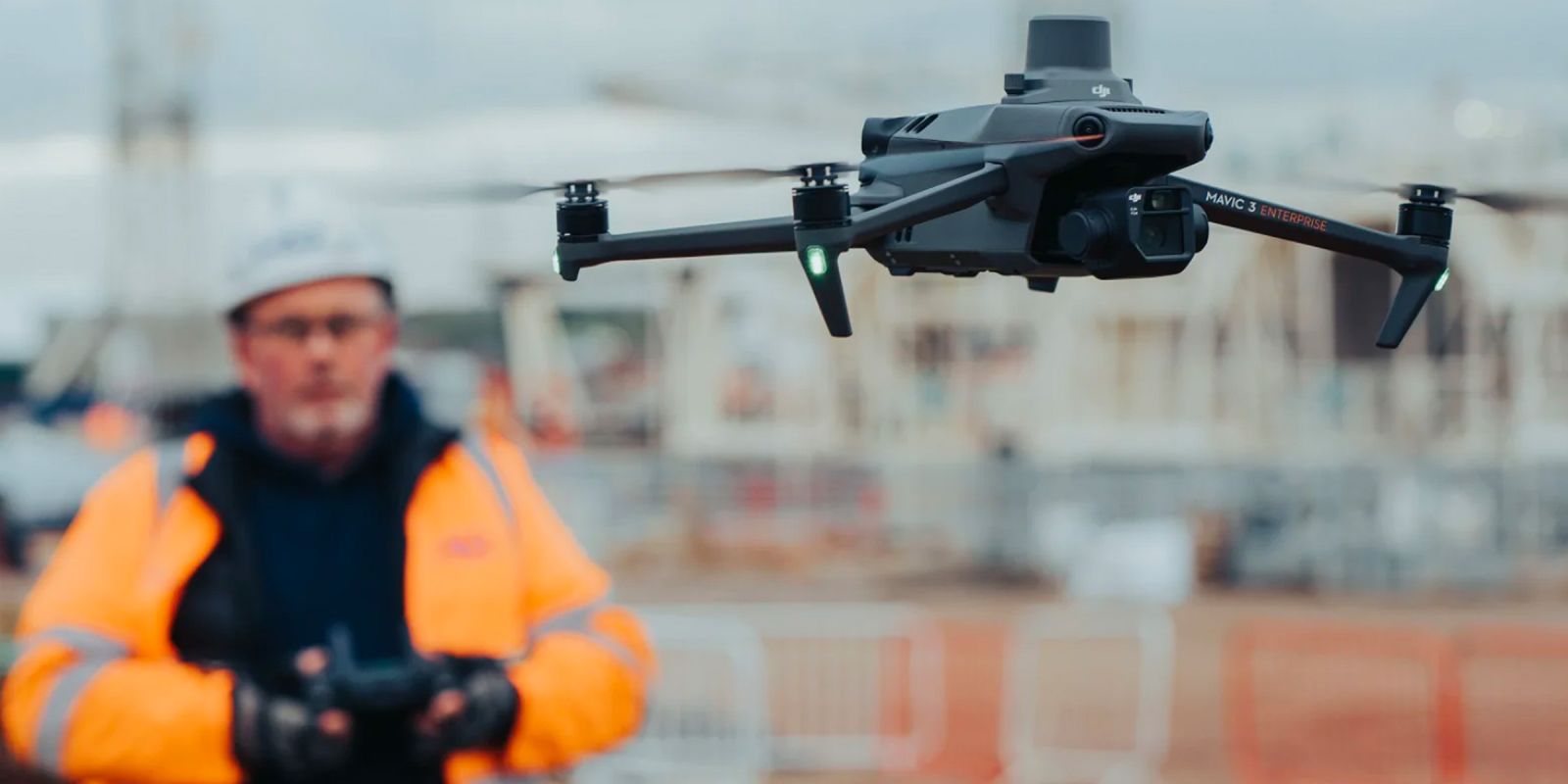
The difficulty of conventional site surveying is that it can quickly become a costly, time-consuming process – additional manpower, equipment, and health and safety requirements all add up. BBV recognised this, and brought in the Mavic 3 Enterprise drone to efficiently and accurately survey their sites, saving time and money.
For the HS2 Project, BBV faced the following major challenges:
- Conducting regular and efficient surveys over a 90km stretch
- Keeping the project on-schedule and on-budget - especially as traditional survey techniques can be time-consuming and labour intensive
- Sharing, storing, and centralising masses of data
- Reducing the project's carbon footprint
- Ensuring onsite staff safety, considering traditional methods of monitoring stockpiles and earthworks are potentially dangerous
Key project results
While drones have already been employed across previous projects, BBV chose to replace their Phantom 4 RTK with the Mavic 3 Enterprise – a decision that has delivered drastic improvements across the following areas.
Improved efficiency
For BBV, a typical drone stockpile survey takes 10-20 minutes, compared to a full day for manual measurement and transport requirement calculations. With the Mavic 3 Enterprise flying at a 50 metre altitude at low speed, BBV can now survey approximately 1 kilometre of mainline in 45-60 minutes. Again, this same survey would take a full shift if performed manually on foot. In addition, BBV can obtain 20-25 mm accuracy without any ground control points.
Improved health and safety
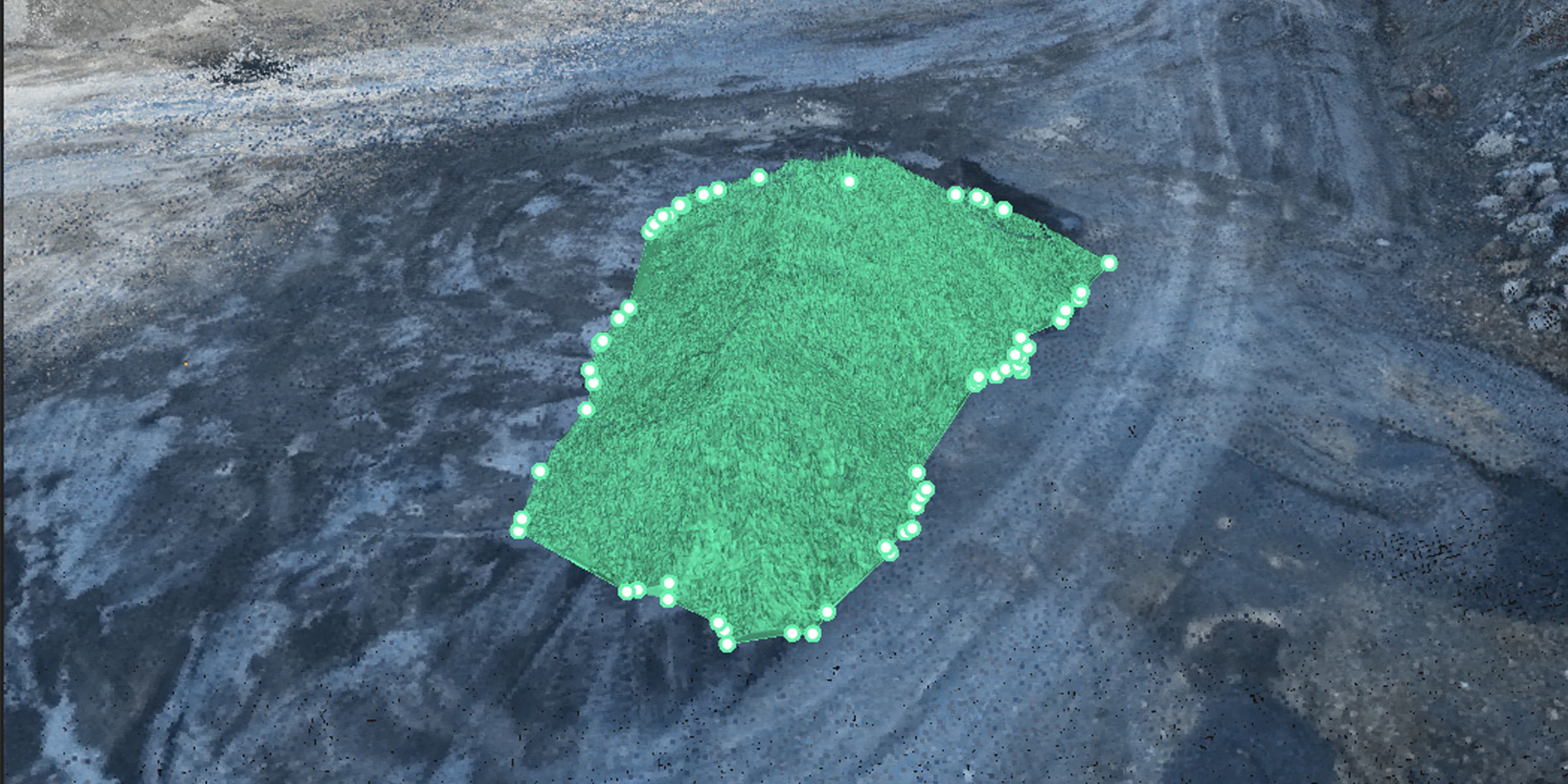
Manual inspection is often fraught with risk, and requires extensive health and safety setup, monitoring, and reporting. For the HS2 Project, some of their stockpiles are up to 10 metres high and would require people to traverse large quantities of unstable material with unsafe footing.
Using the Mavic 3 Enterprise, BBV can remotely and safely collect this key data without any risk to personnel. In addition, some surveys were previously excluded due to their proximity to plant, or had to be carried out when plant was inoperational. These surveys can now easily be performed without any costly downtime.
Improved cost savings
By utilising drone technology, BBV will save an estimated $10 million (£5 million) across five years. This includes $40,000 (£20,000) a year saved on monthly progress surveys, and $60,000 (£30,000) a year saved by removing 800 ‘working at risk days’ due to better monitoring of aggregate stockpiles. The number of required site visits is also greatly reduced, further reducing costs and also cutting carbon emissions across the project.
Mavic 3 Enterprise vs Phantom 4 RTK
With its ability to fly longer and cover larger areas in a single flight, the Mavic 3 Enterprise has given BBV more accurate data in half the time of the Phantom 4 RTK.
Used for material stockpiling and concrete production for railway infrastructure, BBV’s 55-acre Kingsbury compound is the size of 74 football pitches. The following table demonstrates the significant improvements achieved with the Mavic 3 Enterprise:
| Location | Flight Time | Battery Remaining |
|---|---|---|
| Ponds Area (4.8 km) | Mavic 3E: 8 minutes Phantom 4 RTK: 16 minutes |
Mavic 3E: 71% Phantom 4 RTK: 33% |
| Office Area | Mavic 3E: 12 minutes Phantom 4 RTK: 29 minutes |
Mavic 3E: 64% Phantom 4 RTK: 20% & 56% (two flights) |
Check out our DJI Phantom 4 RTK vs DJI Mavic 3 Enterprise blog for a more detailed direct comparison of specifications and features between these two surveying and mapping drones.
The use of the Mavic 3 Enterprise on the HS2 Project has already delivered impressive results, and will continue to help BBV be more efficient, safe, and cost-effective over the next 5 years. While the adoption of drone technology on New Zealand infrastructure and construction projects is still in its infancy, the potential applications and results are evident. If you’re ready to see similar improvements across your surveying, mapping, and inspection projects, please get in touch today – we’re happy to help.
SPEAK WITH A SPECIALIST
Contact our team today to discuss the right solution for you.
Related content
Precise stockpile measurement is an essential part of operations for a wide range of industries. Read now to learn how drone and software solutions are revolutionising this vital technique.


