Crumbling hillsides, road blockages, damaged homes and properties. These are just a few of the consequences of slips and landslides. Whether caused by long-term erosion, heavy rainfall, or earthquakes, the results can be devastating. Prevention and mitigation planning are the best courses of action for managing slips and landslides, and this is where accurate surveying comes into play.
But what are the options available if you need a slip survey, and how is drone and LiDAR technology delivering faster, safer, and more accurate results? Read our full case study now to find out.
Contents
Slip and landslide risk assessment Traditional surveying options Drone + LiDAR slip surveying
1. Slip and landslide risk assessment
While accurately predicting slips and landslides can be difficult, these key warning signs (as shown at landslides.nz ) can help you determine if your property is at risk:
- Changes in your landscape such as patterns of stormwater drainage on slopes (especially where runoff water converges) land movement, small slides, flows, or progressively leaning trees.
- Doors or windows stick or jam for the first time.
- New cracks appear in plaster, tile, brick, or foundations.
- Outside walls, walks, or stairs begin pulling away from the building.
- Slowly developing, widening cracks appear on the ground or on paved areas such as streets or driveways.
- Underground utility lines break.
- Bulging ground appears at the base of a slope.
- Water breaks through the ground surface in new locations.
- Fences, retaining walls, utility poles, or trees tilt or move.
- A faint rumbling sound that increases in volume is noticeable as the landslide nears.
- Unusual sounds, such as trees cracking or boulders knocking together, might indicate moving debris.
- Collapsed pavement, mud, fallen rocks, and other indications of possible debris flow can be seen when driving (embankments along roadsides are particularly susceptible to landslides).
In addition, you can contact your local council for records of historical slips, or consult the GNS Landslide Database map , though these records are not complete.
Drone footage of slips and landslides in Muriwai, New Zealand. Source: https://landslides.nz/
2. Traditional surveying options
Suitable for small or medium-sized projects, the below surveying options are considered the industry-standard approaches, delivering accurate, reliable results. However, they also depend on the accessibility and visibility of survey points, and require additional manual labour, time, and costs to complete.
Robotic total station
A robotic total station contains two main parts – a telescope and controller. The telescope takes measurements, while the controller manoeuvres the telescope and automates its positioning. Typically used by single person survey teams, robotic total stations can create three-dimensional project maps, designs, and volume calculations. They can also be used to check grade, and to verify as-builts or property boundaries.
GNSS rover
GNSS (global navigation satellite systems) receivers and rovers with RTK (real time kinematics) deliver centimetre-level accuracy for surveying and mapping. Using data obtained from satellite-based positioning systems, GNSS rovers find exact locations and elevations, calculate grade, measure ground, saw cut, surface tie-in points, and as-built points.
While both have their advantages, they require methodical land coverage on foot to collect measured points to trace features, followed by a gridded approach to establish the topography’s shape. When compared to drone surveying, these methods take much longer, carry higher risk to the people involved, and deliver far fewer data points, which leads to a lower quality data set.
3. Drone + LiDAR slip surveying
Conducting slip surveys is essential for identifying high-risk areas, assessing the stability of slopes, and implementing necessary mitigation measures. With the inherent risks associated with manual surveying, as well as the added time and cost factors, drones have emerged as a major upgrade for slip surveying in New Zealand.
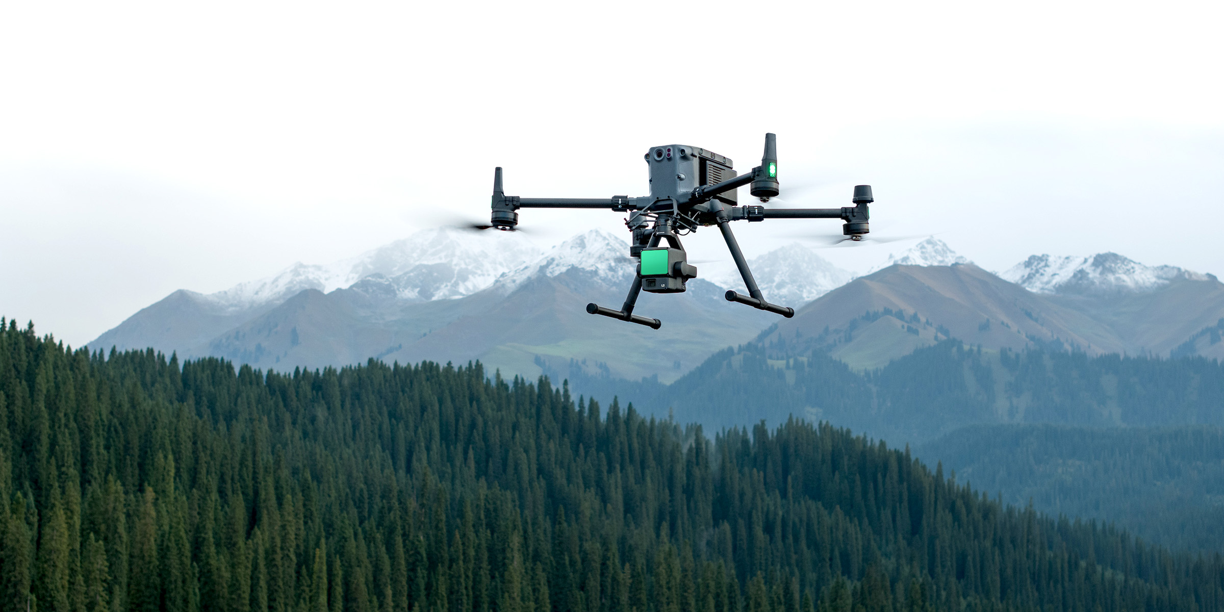
When equipped with a LiDAR system such as the Zenmuse L2 , aerial drones become the leading solution for accurate, efficient landslide and slip surveying. We recently spoke with Michael Cutfield, General Manager at Survey Worx , about the surveying work his team has been doing, and how drones have helped deliver precise, timely site data.
Market leaders in land surveying, Survey Worx have increasingly been using drones for slip assessment in recent years, as it becomes the industry standard for reality capture for remediation design purposes.
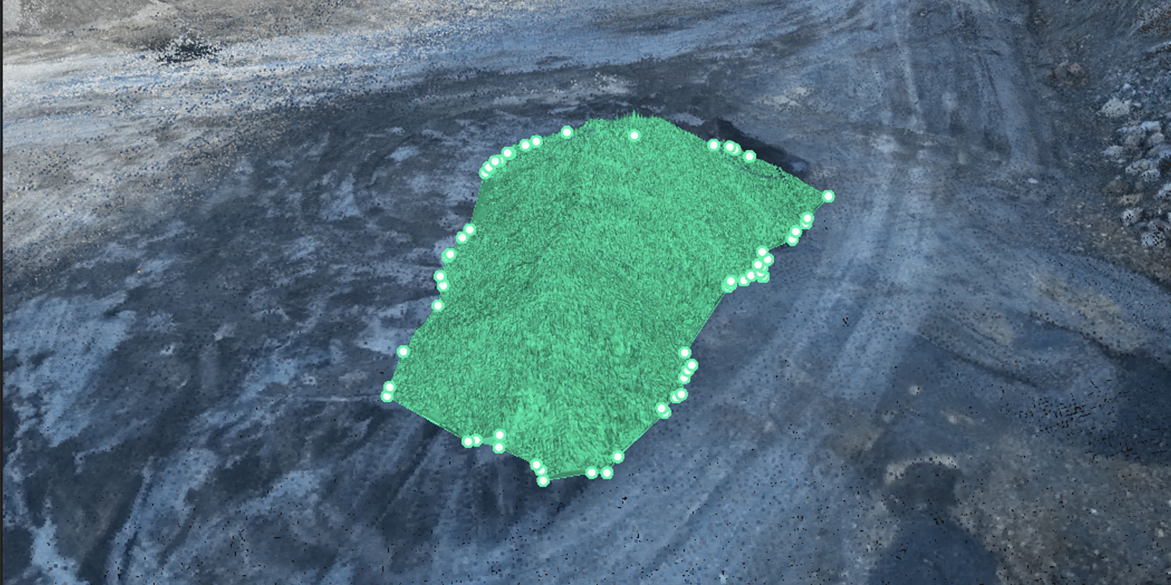
Supported by the Ferntech team, they use DJI drones to capture raw photogrammetry and LiDAR data via aerial site assessments. This raw data is then processed to produce point clouds, with the photos run through photogrammetry software and the LiDAR run through DJI Terra. These point clouds are cross-checked and compared with the ground control points (GCPs) for accuracy.
Once accuracy is confirmed, the features of the point cloud are modelled, the ground surface is extracted and contoured, and the orthomosaic image is placed to produce a plan. The point cloud is tidied up by reducing the noisy points and is sometimes decimated if it is too large.
Upon completion, Survey Worx produces a plan in pdf format, including the photo, CAD features, contours, and annotation explaining all the features. This plan is also issued in digital CAD format together with the digital image correctly geolocated, as well as the point cloud – all of which can be used by the designers. When asked about the key benefits of using drones for this line of work, Mr Cutfield identified the following three factors:
- Using drones for survey mapping significantly increases productivity on large sites, which improves exponentially as site size increases;
- Data quality is improved as millions of data points are collected compared to 100s or 1000s via traditional methods, resulting in topology that is much more accurately defined;
- By using remote sensing to collect data, drones dramatically improve safety as people no longer need to be physically present for data collection.
The combination of New Zealand’s unique landscape, weather patterns, and seismic activity make it particularly prone to major slips and landslides. By using drone and LiDAR technology to complete regular, detailed slip surveys, we can better understand the stability of our properties, identify potential risks, and implement stronger preventative measures before slips occur.
As New Zealand’s drone experts, we’re proud to support our country’s surveyors and engineers with the world’s latest slip surveying technology.