


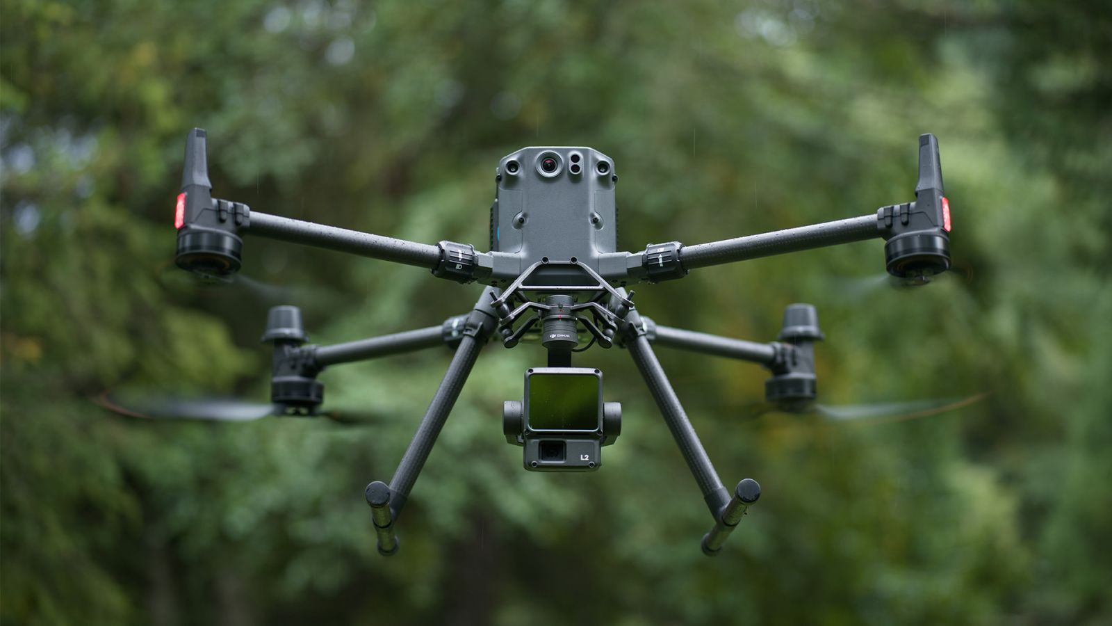
DJI Zenmuse L1 vs Zenmuse L2 – Key Differences
Upon its release, the DJI Zenmuse L1 changed the game for surveying, mapping, and inspections, providing an accessible, easily integrated LiDAR payload solution that generated precise 3D point cloud models – available for a fraction of the cost of similar systems. With the release of the new DJI Zenmuse L2, DJI has built on what made the L1 so successful, delivering an advanced aerial LiDAR solution that offers greater precision, efficiency, and reliability. Read our blog below to learn about the main differences between the Zenmuse L1 and Zenmuse L2.
DJI Zenmuse L1 vs DJI Zenmuse L2 – a significant upgrade
“The DJI Zenmuse L2 marks a new era of 3D data acquisition,” said Christina Zhang, Senior Director of Corporate Strategy at DJI. “Three years ago DJI was excited to introduce a reliable and cost-effective LiDAR system for aerial platforms used by land surveyors, electricity inspectors, and forestry professionals, to name just a few. This aerial data is paramount in providing real-time 3D data, efficiently capturing the details of complex structures and delivering highly accurate reconstructed models.”
With these comments in mind, below is a comparison of key specifications for the Zenmuse L2 and Zenmuse L1:
| DJI Zenmuse L2 | DJI Zenmuse L1 | |
|---|---|---|
| Dimensions | 155 x 128 x 176 mm | 152 x 110 x 169 mm |
| Weight | 905±5 g | 930±10 g |
| Power | 28W (typical) 58W (max) |
30W (typical) 60W (max) |
| IP Rating | IP54 | IP54 |
| Supported Aircraft | M300 RTK (requires DJI RC Plus); M350 RTK |
M300 RTK M350 RTK |
| System Efficiency | The operating area of a single mission can reach 2.5km squared. Relative altitude: 150m; Flight speed: 15m/s |
The operating area of a single mission can reach 2km squared. Relative altitude: 100m; Flight speed: 13m/s |
| Detection Range | 450m @ 50% reflectivity, 0klx 250m @ 10% reflectivity, 100klx |
450m @ 80% reflectivity, 0 klx 190m @ 10% reflectivity, 100 klx |
| Point Rate | Single return: max. 240,000 pts/s Multiple returns: max. 1,200,000 pts/s |
Single return: max. 240,000 pts/s Multiple return: max. 480,000 pts/s |
| System Accuracy (DJI stated specs) | Horizontal: 5cm @ 150m Vertical: 4cm @ 150m Both at 150m flight altitude, flight speed 15m/s |
Horizontal: 10cm @ 50m Vertical: 5cm @ 50m Both at 50m flight altitude, flight speed to 10 m/s |
| LiDAR Module: Ranging Accuracy | 2cm @ 150m | 3cm @ 100m |
| Inertial Navigation System Accuracy | Yaw Accuracy: Real-time 0.2°, post-processing, 0.05° Pitch/Roll Accuracy: Real-time 0.05°, post-processing, 0.025° |
Yaw Accuracy: Real-time 0.3°, post-processing, 0.15° Pitch/Roll Accuracy: Real-time 0.05°, post-processing, 0.025° |
| Real-time Point Cloud Colouring Modes | Reflectivity, Height, Distance, RGB | Reflectivity, Height, Distance, RGB |
| LiDAR: Maximum Returns Supported | 240kHz for all modes, including Penta | 240 kHz (single/dual echo mode) 160 kHz (triple-echo mode) |
| LiDAR: Scan Modes (including FOV) | Repetitive scanning pattern: 70° x 3° Non-repetitive scanning pattern: 70° x 75° |
Repetitive scanning pattern: 70.4° x 4.5° Non-repetitive scanning pattern: 70.4° x 77.2 |
| RGB Mapping Camera: Sensor Size & Effective Pixels | 4/3 inch 20MP 0.7 seconds shooting interval |
1 inch 20MP 2 seconds (minimum) shooting interval |
| RGB Mapping Camera: Shutter Speed | Mechanical Shutter: 2-1/2000 s Electronic Shutter: 2-1/8000 s |
Mechanical Shutter Speed: 1/2000 - 8 s Electronic Shutter Speed: 1/8000 - 8 s |
| RGB Mapping Camera: Video Resolution | 4K @ 30fps | 4K @ 30fps |
| Recommended Data Capture Speed | 15m/s | 8m/s to 13m/s |
| Pre-flight High-accuracy IMU Warm-up Required | No | Yes: 5-10 minutes |
| Point cloud Real-time Preview | Support, point cloud rendering optimisation | Support |
.gif)
More powerful hardware and improved efficiency
With the help of aerial LiDAR technology, professionals in mapping, land surveying, forestry, infrastructure management, and electricity inspection can quickly and easily obtain large-scale, three-dimensional spatial information. Compared with traditional manual measurement technology, LiDAR can greatly reduce workloads and field measurement times, and improve detection efficiency.
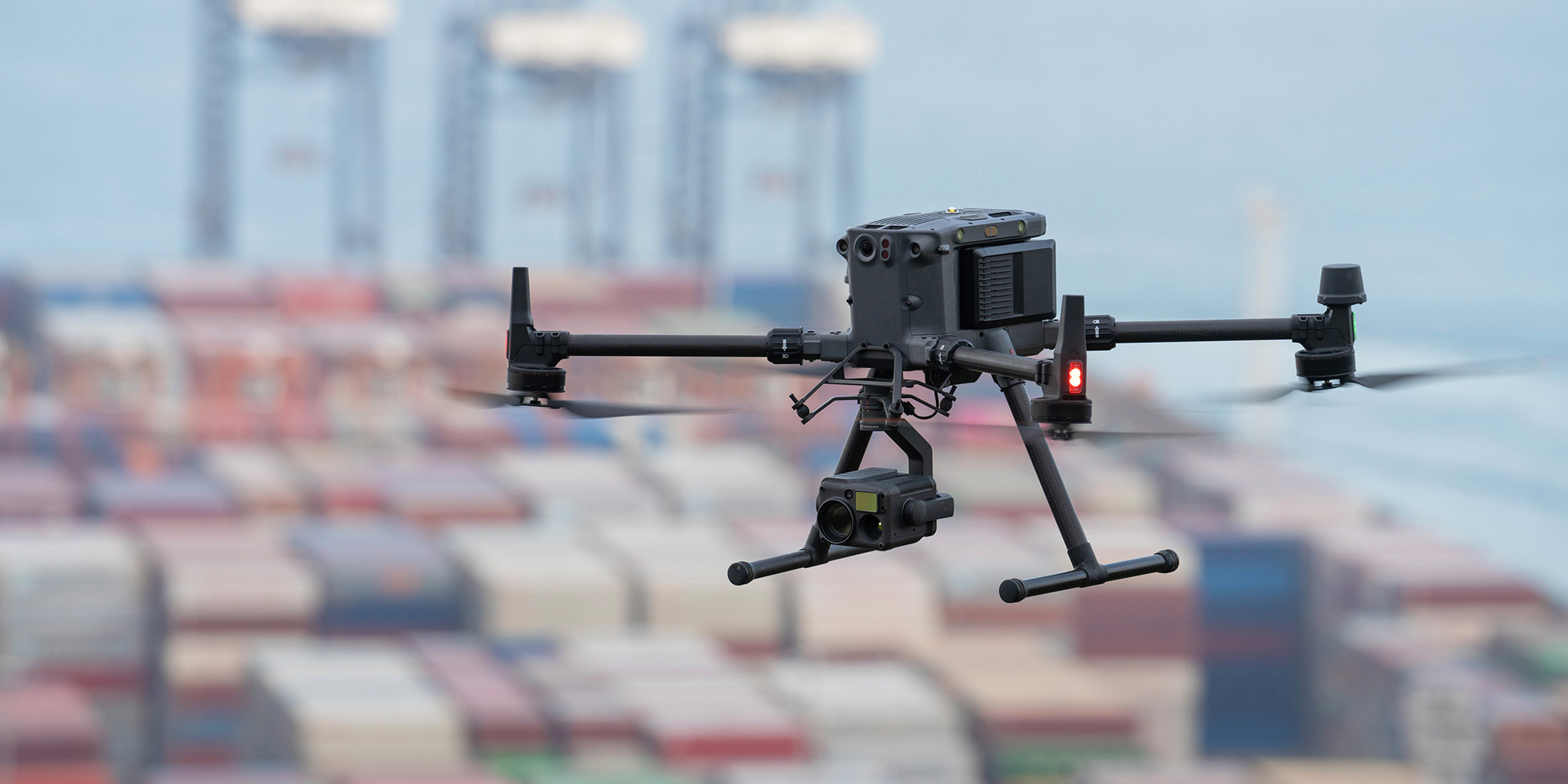
The new Zenmuse L2 integrates LiDAR, a self-developed IMU system, 4/3 CMOS RGB camera, and three-axis gimbal. When equipped with the DJI Matrice 300 RTK or Matrice 350 RTK drones, it produces accurate, efficient, and reliable data collection.
Increased detection range, improved safety
Boasts a 30% increase in detection range, the Zenmuse L2 detects objects from 250 metres at 10% reflectivity and 100k Lux, and up to 450 metres at 50% reflectivity and 0k Lux[1] compared to the Zenmuse L1. Typical operational altitude now extends up to 150 metres, notably improving operational safety and speed.
With a reduced spot size of 4x12 cm @100m, only a fifth of the Zenmuse L1, the Zenmuse L2 detects smaller objects with greater detail, generating more accurate digital elevation models (DEM). In addition, it supports five returns and is capable of penetrating denser vegetation to capture more ground points beneath foliage.
.gif)
In both single and multiple return modes, Zenmuse L2 can reach a max point cloud emission rate of 240,000 points per second, acquiring more point cloud data in a shorter time frame.
Key camera upgrades:
- The sensor's RGB mapping camera features a 4/3 CMOS with mechanical shutter and enlarged pixel size to 3.3 μm.
- The effective pixels now reach 20 MP, resulting in a significant improvement in overall imaging, as well as more enriched colourized point cloud details.
- The minimum photo interval has been reduced to 0.7 seconds and the mapping camera has a shutter count of up to 200,000 times, further reducing operational costs.
- If point cloud collection is not needed, the RGB camera can still take photos and videos, or collect images for visible light mapping.
When attached to DJI's flagship Matrice 350 RTK, operational efficiency is improved with both LiDAR point cloud and RGB data collected from a 2.5km area in a single flight.[2] At a typical working height of 150 metres, the Zenmuse L2 3D point cloud model has an elevation accuracy of 4 cm and a plane accuracy of 5 cm, meeting the requirements of 1:500 high-precision terrain surveying.
.gif)
Take control with DJI Pilot 2 and DJI Terra
Used during drone operation, DJI Pilot 2 supports three display modes – RGB, point cloud, and point cloud/RGB side-by-side display, presenting operational results in an intuitive way.
Activating RNG (Laser Rangefinder) enables access to the distance information between the LiDAR module and the object in the centre of the FOV, enhancing flight safety. It also supports four real-time point cloud colouring modes – reflectivity, height, distance, and RGB. Additionally, operators can quickly preview the recorded 3D point cloud model[3] to experience real-time monitoring of operational progress.
.jpg)
Through DJI Pilot 2, the Zenmuse L2 can automatically generate route operation quality reports after the completion of route tasks, with point cloud playback and splicing functions. A quick preview of the point cloud results can be viewed on site, and if the data is abnormal, shots can be retaken to avoid repeated outings.
With DJI Terra, the Zenmuse L2 enables efficient and reliable one-stop point cloud post-processing. After the point cloud trajectory is solved and the point cloud accuracy is optimised, a 3D point cloud in standard format can be generated with one click. The ground point is then classified, and DJI Terra creates the digital elevation model (DEM). Accuracy control and inspection functions can then be used to analyse the result.
.jpg)
By combining the DJI Zenmuse L2 with a DJI Matrice 300 RTK or DJI Matrice 350 RTK drone, as well as the DJI Pilot 2 and DJI Terra software solutions, you have the ideal aerial tool for a range of industries and applications. From topographic mapping for surveyors, to LiDAR canopy penetration and plant monitoring in the forestry industry, and power line analysis and reconstruction with point cloud data – the Zenmuse L2 does it all. Please get in touch with our commercial team today if you’d like to learn more about the Zenmuse L2 and our other LiDAR solutions, or for a free quote.
[1] The data presented are typical values. Measured using a flat subject with a size larger than the laser beam diameter, a perpendicular angle of incidence, and an atmospheric visibility of 23 km. In low-light environments, the laser beams can achieve the optimal detection range. If a laser beam hits more than one subject, the total laser transmitter power is split and the achievable range is reduced. The maximum detection range is 500 m.
[2] Measured with Zenmuse L2 mounted on Matrice 350 RTK with a flight speed of 15 m/s, flight altitude of 150 m, side overlap rate of 20%, Calibrate IMU enabled, Elevation Optimisation turned off, and terrain follow turned off.
[3] 3D models are processed by sparse representation.
SPEAK WITH A SPECIALIST
Contact our team today to discuss the right solution for you.
Related content
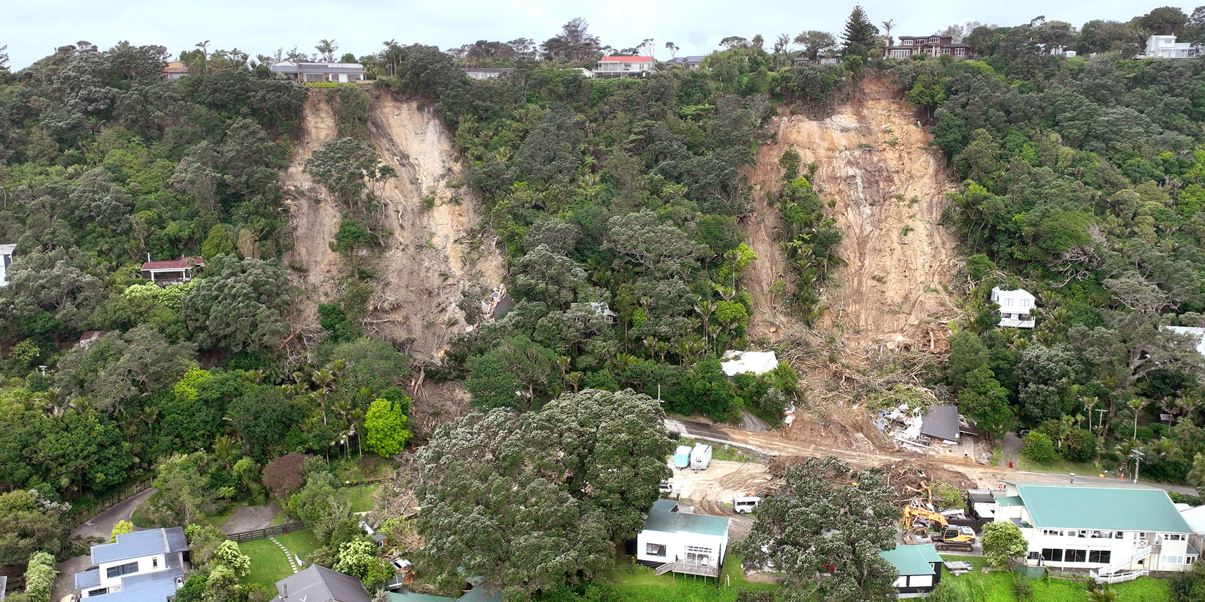
What are the best options available if you need a slip survey, and how is drone and LiDAR technology delivering faster, safer, and more accurate results? Read our full case study now to find out.
What are the key differences between the DJI Matrice 300 RTK and DJI Matrice 350 RTK, and do you need to upgrade your drone? Read our latest blog to find out.


