


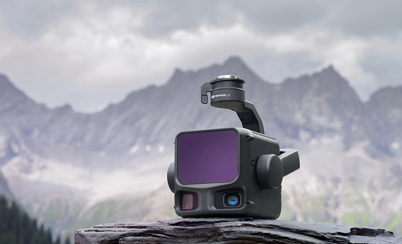
Unlocking the Potential of the DJI Zenmuse L3 Payload
At Ferntech, we’re always looking to equip our clients with the latest, most capable drone-based solutions. The DJI Zenmuse L3 LiDAR payload stands out as a major leap in drone surveying and mapping technology — and here’s why it deserves serious consideration.
What the Zenmuse L3 Brings to the Table
The Zenmuse L3 is an advanced LiDAR payload designed for professional drone operations. Built to deliver long-range, high-accuracy data capture, it gives inspection, surveying and mapping workflows a powerful upgrade.
.jpg)
Here are the key advantages that matter for NZ operations.
1. Richer Data with Multiple Returns
The L3 supports up to 16 returns per pulse, meaning a single laser pulse can capture reflections off multiple surfaces (e.g., vegetation canopy, sub-canopy, ground). In practice for New Zealand customers that means:
- More accurate terrain modelling under tree cover or in forested environments.
- Improved detail in urban or structural inspections (roofs, facades, utility infrastructure).
- Better classification between natural and built features.
This sort of depth is becoming increasingly important in sectors like forestry, utilities, civil infrastructure and large-scale site modelling.
2. Flexible Scanning Modes for Varied Missions
The Zenmuse L3 offers three intelligent scanning modes — Linear, Star-Shaped and Non-Repetitive. Each mode is optimised for different mission types:
- Linear: High precision, predictable coverage — ideal for corridor surveys, engineering-grade topographic.
- Star-Shaped: Balanced ground coverage and accuracy — great for environmental monitoring, agricultural sites.
- Non-Repetitive: More complex geometry capture, building facades, urban modelling where vertical details matter.
.jpg)
3. Adaptive Sampling Rate — Match Mission to Conditions
The L3 has an adjustable sampling rate (e.g., from ~100 kHz to 2 MHz) so you can prioritise range, density or penetration depending on your task:
- Use higher sampling rates for low-altitude high-detail work (e.g., stockpile surveys, rooftop capture).
- Use lower sampling rates for long-range or high-altitude work (e.g., wide terrain scans, forestry canopy penetrations).
This flexibility is key in NZ’s varied terrain — from flat open paddocks to forested hills, coastal zones and complex infrastructure corridors.
4. Long-Range & High Precision Performance
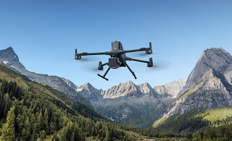
The L3 offers exceptional measurement range (up to ~950 m under certain conditions) and vertical/horizontal accuracy that supports 1:500 to 1:1000 scale mapping. For Ferntech’s customers, especially in large or remote-site operations (e.g., mining, rail, regional utilities), this means fewer flights, larger coverage, and more efficient data collection.
5. Dual 100 MP RGB Cameras — Simultaneous LiDAR + Photogrammetry
One of the big strengths of the L3 is its ability to capture high-resolution RGB imagery while doing LiDAR. The dual 100 megapixel (M4/3) sensors mean:
- True-colour orthophotos that match the geometric precision of the LiDAR point clouds.
- Better visual asset creation (for presentations, stakeholder engagement, asset registers) in addition to “just the numbers.”
- Reduced flight time/cost — you can complete a mission that yields both LiDAR and high-res imagery in one shot, rather than separate flights.
For customers across NZ — from utilities to infrastructure — this means one payload can adapt to a variety of jobs, rather than needing a separate tool for each.
6. Smart Mission Efficiency
The L3 isn’t just high performance — it’s designed to work smarter:
- Designed flight patterns (Z-shapes, terrain-following) help ensure coverage, overlap and consistent altitude relative to ground even on undulating terrain.
- L3 supports oblique collection of five directional flight paths, such as collecting building facade information. This helps to produce more complete and realistic digital assets.
- Integration with the major software workflow means you’re not just collecting data — you’re set up for delivery of useful outputs.
7. Seamless Workflow Integration
The L3 pairs with software platforms like DJI Terra and DJI Modify (and supports import into third-party workflows) to deliver end-to-end capture-to-product workflows (point-clouds, orthos, mesh models, 3D Gaussian Spatting models).
Why It Matters in the New Zealand Context
At Ferntech we see a number of compelling reasons why the Zenmuse L3 is especially relevant for NZ organisations:
- Remote & challenging terrains: Whether forestry on steep slopes, regional transport infrastructure, or utility corridors across rugged terrain — the range and penetration capabilities are very useful.
- Large-scale infrastructure & utilities: NZ customers (rail, pipelines, powerlines, regional councils) need high-accuracy mapping over long distances — the L3 supports that.
- Efficiency & cost-savings: One flight, two datasets (LiDAR + RGB) = reduced operational cost and faster job completion.
- Environmental & sustainability focus: For our customers who are tracking vegetation, canopy health, carbon-reporting or forest monitoring, the multiple returns, dense point-clouds and imagery capabilities combine into a strong package.
Ferntech’s Support for You
As New Zealand’s exclusive DJI Enterprise distributor — Ferntech is uniquely placed to support you in getting the most from the Zenmuse L3. Here’s how:
- Demonstration sessions: See the L3 in action in NZ conditions.
- Full integration support: We don’t just supply the hardware — we help with mission planning, software workflows, calibration and training.
- Service and support network: With retail stores and service centres in Auckland and Christchurch, we provide fast support, maintenance and repair services.
Summary
If you’re looking to elevate your aerial data capture, whether for infrastructure, surveying or forestry — the DJI Zenmuse L3 is a standout payload that offers versatility, precision and efficiency. At Ferntech we’re ready to help you deploy this technology within the NZ environment, so you gain the full benefit.
Ready to explore? Get in touch with Ferntech’s specialist team via the form below to arrange a demo, consultation, or integration planning.
SPEAK WITH A SPECIALIST
Contact our team today to discuss the right solution for you.


