DJI Zenmuse P1 (Rental)

Contact for Pricing
SKU: P1_RENTAL

Or 4 interest-free payments of $212.50 with

The Zenmuse P1 integrates a full-frame sensor with interchangeable fixed-focus lenses on a 3-axis stabilized gimbal. Designed for photogrammetry flight missions, it takes efficiency and accuracy to a whole new level.


In Stock Ready For Dispatch

Auckland Click & Collect: No Stock

  • Free Shipping on all orders over $300
  • Order before 2.00pm for same day dispatch
  • Click & collect from Auckland & Christchurch stores
  • Local warranty, support and repairs

$850 inc GST daily rental.

If you wish to purchase within 3 months of rental, one days rental will come off the purchase price


The New Benchmark for Aerial Surveying

The Zenmuse P1 integrates a full-frame sensor with interchangeable fixed-focus lenses on a 3-axis stabilized gimbal. Designed for photogrammetry flight missions, it takes efficiency and accuracy to a whole new level.

Key Features

Accuracy without GCPs: 3cm horizontally/5cm vertically.

High Efficiency 3 kmcovered in a single flight.

45 MP Full-frame Sensor

Smart Oblique Capture

Global Mechanical Shutter, Shutter Speed 1/2000 Seconds

TimeSync 2.0 - synchronization at the microsecond level

Extraordinary Efficiency
The P1 includes a full-frame, low-noise high-sensitivity sensor that can take a photo every 0.7 s during the flight, and covering 3 km2 in a single flight.

Remarkable Accuracy
Equipped with a global mechanical shutter and the all-new TimeSync 2.0 system, which synchronizes time across modules at the microsecond level, the Zenmuse P1 lets users capture centimeter-accurate data combined with the real-time position and orientation compensation technology.

Robust Versatility
Create 2D, 3D, and detailed models thanks to the integrated 3-axis gimbal that can be outfitted with 24/35/50mm lenses and the Smart Oblique Capture feature.

Multiple Fixed-focus Lens Options
Global Mechanical Shutter, Shutter Speed 1/2000 Seconds
Sends the median exposure pulse in microseconds
Supports 24/35/50mm lenses with DJI DL mounts

Smart Oblique Capture
Cover 7.5 km2 in a single workday with the P1. Elevate the efficiency of your oblique photography mission using Smart Oblique Capture, where the gimbal automatically rotates to take photos at the different angles needed. Only photos essential to the reconstruction will be taken at the edge of the flight area, increasing the efficiency of post processing by 20% to 50%.

Smart Data Management
Mission result files are automatically associated with the Mission Name and Mission Time.
A centralized storage location for photos, GNSS data, and TimeStamps.MRK files.
The image metadata contains the camera’s intrinsic and extrinsic parameters and the status of RTK.

Fieldwork Report
Verify data quality immediately post-flight by checking the position data and number of the images acquired, as well as RTK status and positioning accuracy.


A Mission Mode for Any Scenario

2D Orthomosaic Mission
Effortlessly acquire oblique images from multiple angles that meet 3D modeling requirements across industries such as urban planning and centimeter-level accurate cadastral surveys to serve 3D reality models and smart city planning.

3D Oblique Mission
Effortlessly acquire oblique images from multiple angles that meet 3D modeling requirements across industries such as urban planning and centimeter-level accurate cadastral surveys to serve 3D reality models and smart city planning.

Detailed Modeling Mission
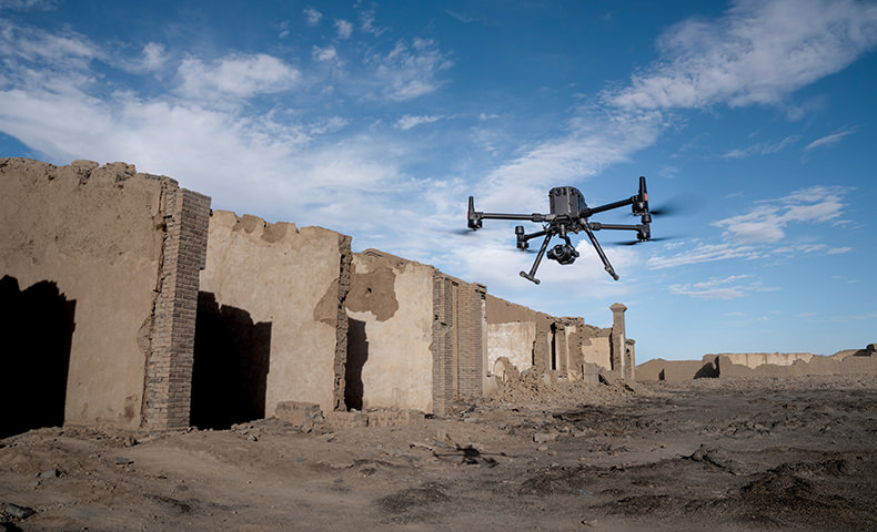
Acquire ultra-high resolution image data of vertical or slanted surfaces from a safe distance that faithfully recreates fine textures, structures, and features, for detailed reconstructions, geological surveys, heritage site conservation, hydraulic engineering, and more.

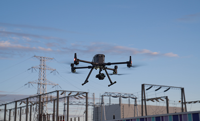
Real-time Mapping Mission
Gather geographic information of large areas in real-time using DJI Terra so that teams can make crucial decisions quickly on site.


Zenmuse P1 Brochure

Product Specifications


Dimensions: 198×166×129 mm
Weight Approx:. 787 g
Power: 13 W
IP Rating: IP4X
Supported Aircraft: Matrice 300 RTK
Operating Temperature Range: -20° to 50° C (-4° to 122° F)
Storage Temperature Range: -20° to 60° C (-4° to 140° F)
Absolute Accuracy: Horizontal: 3 cm, Vertical: 5 cm *
* Using Mapping Mission at a GSD of 3 cm and flight speed of 15 m/s, with an 75% front overlap rate and a 55% side overlap rate.
 

Camera

Sensor: Sensor size (Still): 35.9×24 mm (Full frame)
Sensor size (Max video recording area): 34×19 mm
Effective Pixels: 45MP
Pixel size: 4.4 μm
Supported Lenses: DJI DL 24mm F2.8 LS ASPH (with lens hood and balancing ring/filter), FOV 84°
DJI DL 35mm F2.8 LS ASPH (with lens hood and balancing ring/filter), FOV 63.5°
DJI DL 50mm F2.8 LS ASPH (with lens hood and balancing ring/filter), FOV 46.8°
Supported SD Cards: SD: UHS-1 rating or above; Max capacity: 128 GB
Storage Files: Photo / GNSS Raw Observation Data/ Image Log File
Photo Size: 3:2 (8192×5460)
Operation Modes Capture, Record, Playback
Minimum photo interval: 0.7 s
Shutter Speed: Mechanical Shutter Speed: 1/2000-1/8 s
Electronic Shutter Speed: 1/8000-8 s
Aperture Range: f/2.8-f/16
ISO Range: Photo: 100-25600
Video: 100-3200
 

Video

Video Format: MP4
Video Resolution: 16:9 (3840×2160)
Frame Rate: 60fps
 

Gimbal

Stabilized System: 3-axis (tilt, roll, pan)
Angular Vibration Range: 0.01°
Mount: Detachable DJI SKYPORT
Mechanical Range: Tilt: -125° to +40°; Roll: -55° to +55°; Pan: ±320

In the box

Zenmuse P1 x 1
35mm Lens x 1

WHY BUY FROM US?

By buying from Ferntech, you'll have the confidence that you are dealing directly with New Zealand's leading drone experts. Our staff are knowledgable drone pilots who offer expert advice, trusted support and superior specialist service. Only through us will you receive a full New Zealand warranty, phone and email support, and access to our certified Repairs Centre with DJI-qualified drone technicians. And we guarantee that we will have the best prices on the market — if not let us know and we will match any price (conditions apply).


Warranty Details

What's the resolution of the photos taken by the P1?
The P1 takes photos with a resolution of 8192x5460, or approximately 45 megapixels.
 
Which image/video formats are supported?
The P1 supports the following image/video formats:
  · Images: JPEG, JPEG+DNG;<br>
  · Videos: MP4.
 
What's the shortest continuous shooting interval of the camera?
The shortest continuous shooting interval of the P1 is 0.7 seconds.
 
What's the mechanical shutter speed range of the P1?
1/2000s — 1/8s.
 
What's the single pixel size of the P1?
The single pixel size of the P1 is 4.4μm.
 
Which lenses does the P1 support?
The P1 supports 24mm, 35mm and 50mm lenses with DL mounts.
 
Are there other lenses available for the P1?
No, currently the P1 supports only three industry-specific lenses. The lenses of the P1 are optimized for surveying and mapping scenarios, including optical parameter writing, lens performance recording, and reminders. 
Lenses with other DL mounts can take photos and videos manually when installed on the the Zenmuse P1 camera but cannot support surveying and mapping.
 
Which drones support the the P1?
On which gimbal port can it be installed? Currently, only the The M300 RTK supports the P1. The P1 can be installed only on the No. 1 gimbal port while the The M300 RTK is in Single Gimble mode.
 
Which position is recorded by the photos taken by the P1?
In photos taken by the P1, the exit pupil position at the center of the camera lens is recorded.
 
How does Smart Oblique Capture work?
In Smart Oblique Capture, the P1 adopts a shooting order of nadir, front, left, back, and right. This is the optimal shooting order for oblique photogrammetry data collection.
 
What's the tilt angle range of the camera during the Smart Oblique Capture of the P1?
During Smart Oblique Capture, the tilt angle range of the P1 is from -60° to -90°.
 
What is the relationship between the ground sample distance of the data collected by the P1 and the flying altitude?
The relationship between the ground sample distance and the flying altitude differs between lenses as follows:
  · 24mm lens: GSD=H/55
  · 35mm lens: GSD=H/80
  · 50mm lens: GSD=H/120
 Where GSD is measured in centimeters (cm) and the target distance (H) is measured in meters (m).
 
Does the lens support zooming? How to focus during operation?
No, zooming is not currently supported. Auto focus can be used when in Route mode. Manual focus is required when in Manual mode.
 
What is the Low-noise High-sensitivity mode of the P1?
The Low-noise and high-sensitivity mode of the P1 can improve the camera sensitivity (ISO) while reducing noise levels.
 
In which surveying and mapping scenarios can the P1 be used?
The P1 can be used in multiple surveying and mapping scenarios including:
  · 2D orthomosaic
  · 3D oblique
  · Detailed modeling
  · Real-time mapping
 
What content does the field work report include?
After a flight mission is completed, a field work report is generated for pilots to quickly confirm the quality of field data on site. Information includes:
  · The location of each photo;
  · The number of photos;
  · The RTK positioning status and location accuracy.
 
What does the payload health management system record?
The P1 is connected to the payload health management system in DJI Pilot to record the following:
  · Service time of devices
  · Historical abnormal status
  · Usage count of the shutter
  · Swing count of the gimbal 
Corresponding suggestions on abnormalities and maintenance are then provided to ensure the best performance.
 
Does the M300 RTK support PPK post-processing when used with the P1?
Yes. The task folder stores photos, original GNSS observations, and TimeStamps.MRK files, which are used for PPK post-processing calculations.
 
Which types of APP control does the aerial survey solution of the M300 RTK and the P1 support?
Currently, only DJI Pilot is supported.
 
Which operating modes do the P1 support?
The P1 supports the following operating modes:
  · Aerial photography
  · Oblique photography
  · Corridor mapping flight
  · Waypoint flight
  · Manual operation
 
What are the TimeSync 2.0 features when using the M300 RTK and the P1 surveying solution?
The following TimeSync 2.0 features are available:
  • Output the exposure time interval in microseconds;
  • Time synchronization for the camera, the gimbal, the flight control system, and RTK;
  • Brand new position and orientation compensation function which writes precise exit pupil positions of the camera into the photos based on the positions and orientations of the drone and the gimbal.

There's currently no reviews for this product, be the first to write one.

Write a product review